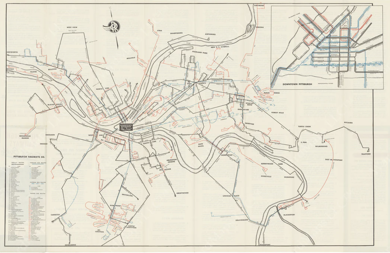
1. Pittsburgh streetcar map in 2D.
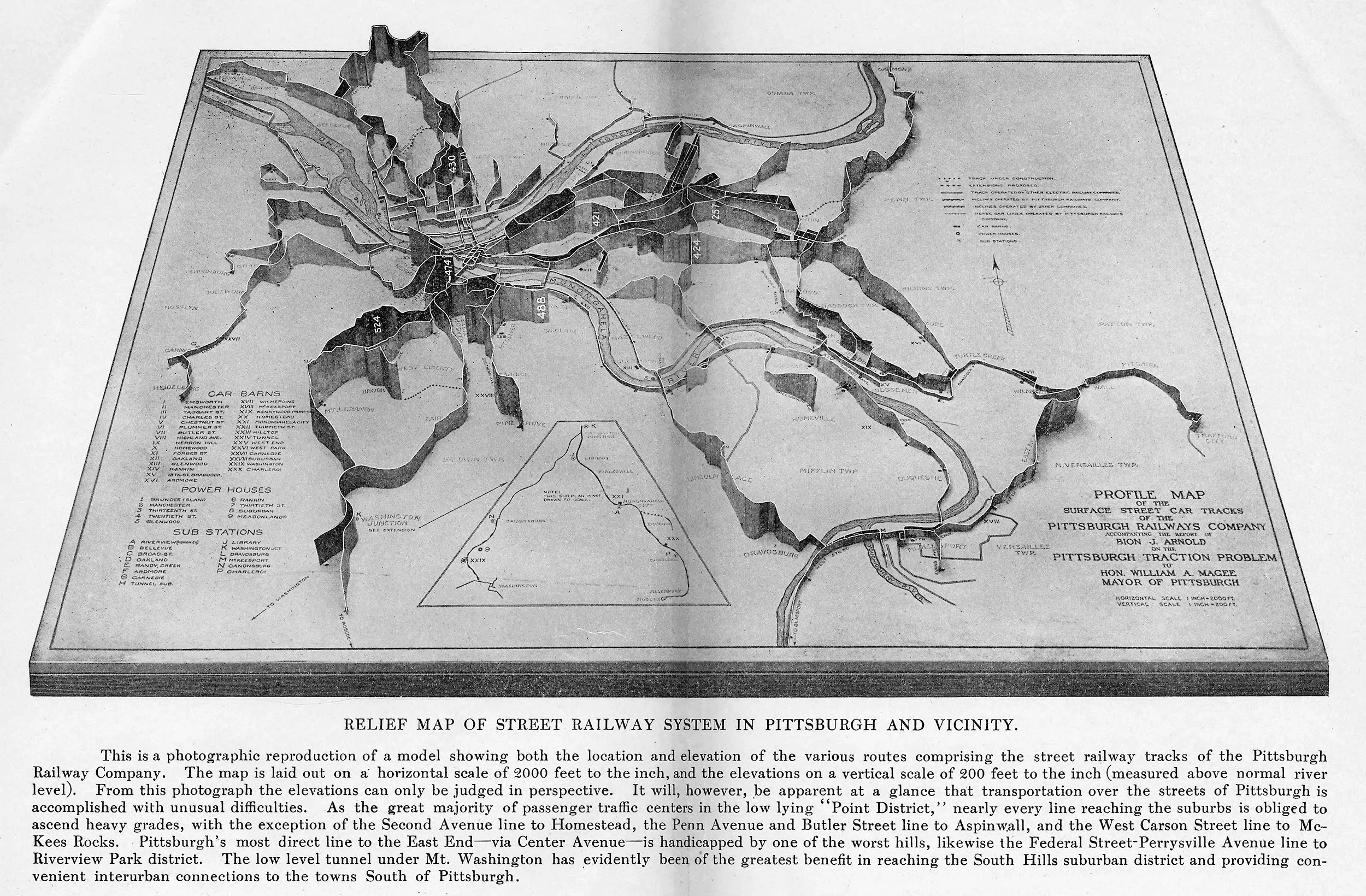
2. Pittsburgh streetcar map in 3D.
(#2 is a 1910 model, submitted to Mayor's office, showing the actual elevation of streetcar lines in #Pittsburgh, that city of inclines.)
How one school made a street safer for kids.
Not a full-on "School Street," where all cars are banned, but a big improvement for health and safety of children.
Before/After.
Two ways to do the #backtoschool run.
Top: drop-off at a school in South Carolina.
Bottom: how kids get to school in #Holland.
The American way: stressed parents, inactive kids, more pollution.
The European way: independent, healthy kids, and cleaner air for all.
They say big trucks are just a reality if you want to make deliveries in the city.
I say there's other ways to solve the "last-mile" problem...
There's your beer kegs—sorted.
#London
🧵
"Bicycles let people move with greater speed without taking up significant amounts of scarce space, energy, or time...Cyclists become masters of their own movements without blocking those of their fellows."